Carbon Storage Update

Hey guys,

Here’s a quick update for the carbon storage project! We sampled DBH (Diameter at Breast Height) for 10 trees at 4 different places (40 total trees) in Wheaton: 1) President Street: between University Place and halfway between East North Path and Harrison; 2) Madison: between Irving and Scott; 3) South Summit street; 4) Liberty Street between Chase & Washington.

IMG_1404

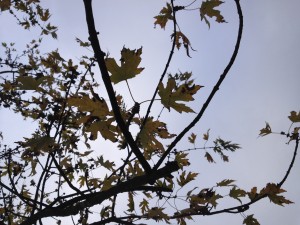
There were many different trees, and a lot of different maple trees! Here’s a picture of a maple tree–we used the leaves to identify species.

From the DBH, we will calculate carbon storage for each tree, and determine average carbon storage for Wheaton.

For now, we’re working on calculations and planning a presentation to families (children and their parents) at the library!

2 comments on “Carbon Storage Update”

  1. ben.norton

    Hey guys. I was wondering how you planned to extrapolate C.S. for all of Wheaton based on C.S. estimations from four sites–all near central Wheaton. How does this account for Belleau Woods, Blackwell, and other areas that are more heavily forested? Thanks

  2. Jesse

    Hey Ben sorry, for the late response. We focused on urban areas near(ish) to elementary schools because we are targeting families and wanted to present to them about the area right outside their front door. We want families to see the carbon storage of the trees on their street, and what kind of trees they can replant (especially if they had a diseased ash tree cut down) to make a positive difference. So perhaps it’s more accurate to say we are extrapolating for the areas of our target audience, rather than the whole city of Wheaton. That said, I do feel like the numbers we obtain would be a fair estimate given that we randomly sampled, but heavily forested areas could impact the numbers.

Leave a Reply